Remote Sensing Insights into Neotectonics and Climate-Driven Hazards in the Hindu Kush-Himalayan Region
Keywords:
Watershed, Tectonics, Lineaments, Drainage Density, Stream Density, Rose PlotsAbstract
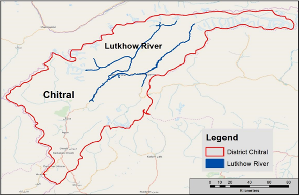
The Hindu Kush–Himalayan (HKH) region is a highly active tectonic belt where continuous uplift and erosion strongly influence river systems. This study investigates the neo-tectonic control and climate-driven hydrological response of the Luthkhow River basin in the Chitral Valley, northern Pakistan, using remote sensing and GIS-based morphometric analysis. Digital Elevation Models and satellite imagery were used to extract drainage networks, watershed boundaries, and lineaments, and key parameters including stream density, drainage density, flow direction, and basin segmentation were analyzed. The basin was divided into seven reaches to assess spatial variability, and a total of 2,663 stream segments were identified, with high drainage density concentrated near glacier-fed tributaries, indicating strong influence of snow and glacier melt. Rose diagram analysis reveals a dominant north–south river flow, while drainage and lineament orientations mainly follow NE–SW to E–W trends. The close correspondence between drainage patterns and lineament directions demonstrates strong structural control and active neo-tectonic deformation. The results confirm that basin evolution is primarily tectonically governed, with cryosphere forcing enhancing erosion and geomorphic response. This study highlights the effectiveness of remote sensing-based morphometric analysis for understanding neotectonic processes in high-mountain environments of the HKH region.