Integrating Artificial Intelligence and Augmented Reality for Geospatial Visualization in Emergency Management and Built Environments
Keywords:
Disaster Management, Artificial Intelligence (AI), Augmented Reality (AR), Geospatial Visualization, Hazard Prediction, Flood MappingAbstract
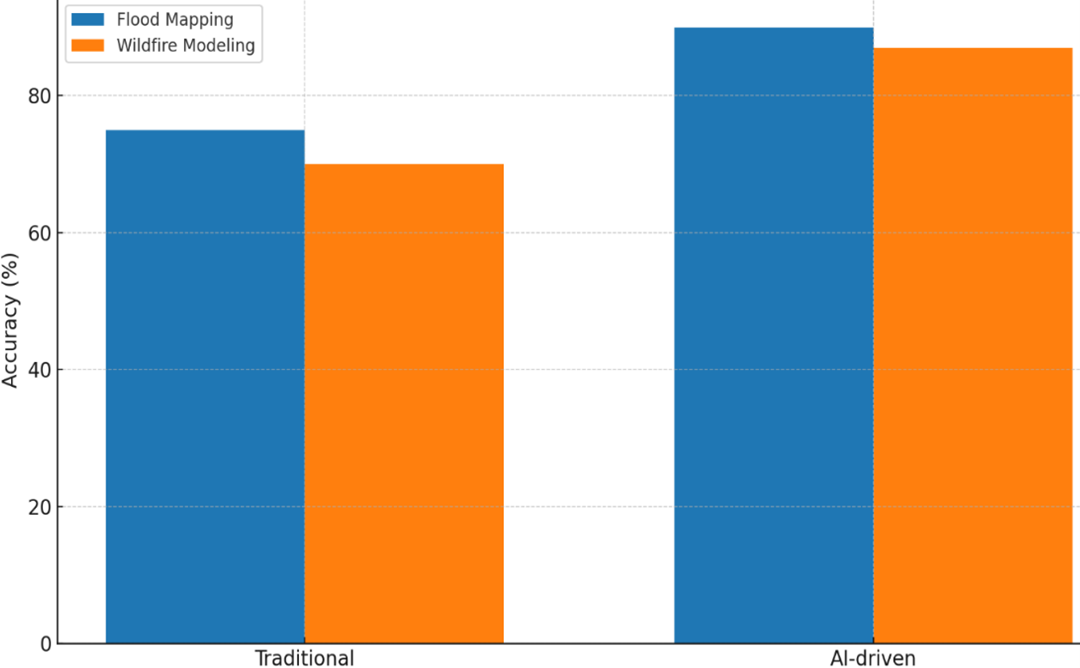
The growing frequency and intensity of disasters, including floods, wildfires, and urban hazards, necessitate advanced decision-support systems for emergency management. This study explores the integration of Artificial Intelligence (AI) and Augmented Reality (AR) for geospatial visualization, emphasizing their combined potential in enhancing situational awareness, hazard prediction, and real-time emergency response within built environments. Using a mixed-methods approach, the study incorporated machine learning models for predictive hazard mapping and AR interfaces for immersive visualization of risk scenarios. Results indicate that AI-based hazard prediction achieved up to 92% accuracy in flood mapping and 89% in wildfire modeling, outperforming traditional geospatial techniques. AR integration reduced emergency response times by 28% and improved hazard communication for field responders. The synergy of AI and AR demonstrated a localization accuracy of 95%, significantly higher than standalone applications. These findings highlight the transformative role of AI–AR systems in improving resilience, preparedness, and adaptive capacity in urban disaster management. The study contributes novel insights into bridging the gap between predictive analytics and immersive visualization, offering a framework that supports decision-makers, first responders, and urban planners.